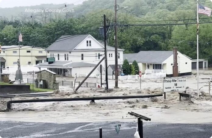
A powerful storm that has already battered the Mid-Atlantic and Southeast U.S. on Wednesday is now threatening to unleash severe thunderstorms and flash flooding across the Washington, D.C. region, placing more than 27 million people at risk.
The National Weather Service (NWS) has issued flash flood warnings for Washington, D.C., Maryland, and parts of Virginia until 8:45 PM ET, with rainfall rates predicted to reach 2 to 3 inches per hour. The risk of flash flooding is significantly heightened due to already saturated soil from recent downpours.
“A Flood Watch has been issued for locations to the east of the Blue Ridge for Wednesday afternoon into Wednesday evening,” NWS Baltimore-Washington posted on X (formerly Twitter).
The storm is part of a broader severe weather system currently sweeping the East Coast, while Texas and New Mexico continue to recover from devastating floods earlier this week. FEMA is actively assisting with recovery operations in those states, where significant casualties have been reported.
In Washington, D.C., storm drains are being overwhelmed, prompting warnings of sudden street flooding, especially in low-lying areas and parks. Areas under immediate threat include:
- Washington, D.C.
- Leesburg
- Warrenton
- Fredericksburg
- La Plata
- Lexington Park
A Severe Thunderstorm Watch has also been issued for the wider Mid-Atlantic region through midnight, with wind gusts up to 70 mph, hail, and even brief tornadoes expected. A tornado was reported in northern D.C. earlier on Wednesday evening.
“Flash flooding is also a major concern with these storms that are expected to produce very heavy downpours,” the NWS emphasized in its latest update.
Residents in affected areas are urged to stay indoors, avoid flooded roads, and monitor local alerts as conditions are expected to deteriorate rapidly into the night.


