


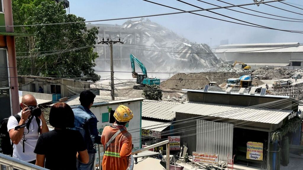
Naypyidaw [Myanmar], March 28: Myanmar experienced a series of six earthquakes on Friday, with two powerful tremors exceeding 7.0 magnitude, according to the National Center for Seismology (NCS).
Details of the Earthquakes:
- 7.2 magnitude quake struck at 11:50 AM IST at a depth of 10km (Lat: 21.93 N, Long: 96.07 E).
- 7.0 magnitude quake followed at 12:02 PM IST, also at a depth of 10km (Lat: 21.41 N, Long: 95.43 E).
- 5.0 magnitude tremor occurred at 12:57 PM IST, at a depth of 10km (Lat: 22.97 N, Long: 95.56 E).
- 4.9 magnitude quake was recorded at 1:07 PM IST, with a depth of 30km (Lat: 22.55 N, Long: 95.34 E).
- 4.4 magnitude earthquake hit at 2:48 PM IST, at a depth of 10km (Lat: 23.35 N, Long: 95.31 E).
- 4.3 magnitude tremor was detected at 3:25 PM IST, at a depth of 10km (Lat: 19.43 N, Long: 95.47 E).
Seismic Threat in Myanmar
Myanmar, located along the collision zone of the Eurasian and Indo-Australian plates, is highly prone to earthquakes. The Sagaing Fault, which runs through Sagaing, Mandalay, Bago, and Yangon, poses significant seismic hazards, affecting 46% of Myanmar’s population.
Historical records indicate that Myanmar experiences around 140 earthquakes annually with magnitudes exceeding 3.0. Notably, in 1903, a 7.0-magnitude earthquake in Bago also impacted Yangon, demonstrating the potential threat to densely populated regions.
Potential Risks & Impacts
- Shallow earthquakes (depth of 10km) like those recorded today pose a higher risk, as they release energy closer to the surface, leading to stronger ground shaking and increased damage.
- The risk of tsunamis along Myanmar’s long coastline remains a concern.
- Despite being earthquake-prone, Myanmar lacks an official national seismic hazard map, making preparedness efforts crucial.
Authorities are closely monitoring the situation for potential aftershocks and damages.