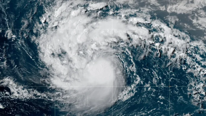
MIAMI — Hurricane Erin has gone from a Category 5 hurricane to a Category 3 storm, but it is still a big storm in the Atlantic that could cause severe waves and rip currents along the coast. The National Hurricane Center (NHC) said that as of Sunday morning, the hurricane’s maximum sustained winds have reduced to 125 mph. However, its wind field is getting bigger, which means that its effects are spreading out more.
From Sunday night to Monday, the storm’s center is expected to move east of the Turks and Caicos Islands and the southeastern Bahamas. Forecasts say the hurricane will move north and avoid making landfall directly in the U.S., but its effects will be felt far beyond the storm’s center. According to a CNN story, hurricane-force winds can stretch up to 25 miles from the center, while tropical-storm-force winds can reach about 205 miles.
People in Florida and other East Coast areas are being told to stay cautious. The National Weather Service in Jacksonville has warned that from August 18 to August 21, there will be dangerous rip currents and strong surf along the Florida coast. On August 19 and 20, the waves are forecast to be over seven feet high. In the next few days, the Bahamas, Bermuda, and most of the U.S. East Coast are expected to have similar dangerous conditions.
Meteorologists have been talking a lot about Erin’s quick growth, which saw it leap from a tropical storm to a Category 5 hurricane in just over 24 hours. The occurrence shows a recent pattern of storms growing more often and more quickly, which scientists say is because the ocean temperatures are getting warmer. Erin is a unique and powerful system, even though it has weakened recently. Only 43 Atlantic storms have ever achieved Category 5 status.
Important Information from the NHC:
Right now, it’s a Category 3 storm with winds of 125 mph.
Location: 150 miles north of Puerto Rico, traveling west-northwest at 14 mph.
There is a tropical storm warning for the Turks and Caicos Islands and a tropical storm watch for the southeastern Bahamas.
U.S. Impact: The storm is not projected to hit land directly in the continental U.S., but severe surf and rip currents are expected along the East Coast, from Florida to Maine.


